Mt. Nagata

Mt. Nagata

Starting point for trekking… Yodogawa Trail Entrance
               (Recommended route to Mt. Nagata)

Access to starting point… 32 km from Miyanoura (1 h 25 min. by car)
              / 23 km from Anbo (1 hour by car)

NEAREST BUS STOP… No.72 Kigensugi bus stop 
       (1.6 km/ 25 min. on foot from bus stop to the trail entrance)

Altitude…1,886 meters 

Distance from the trail entrance…about 10 kilometers 

The time required for round trip…about 13 hours  

Difference in elevation…526 meters 


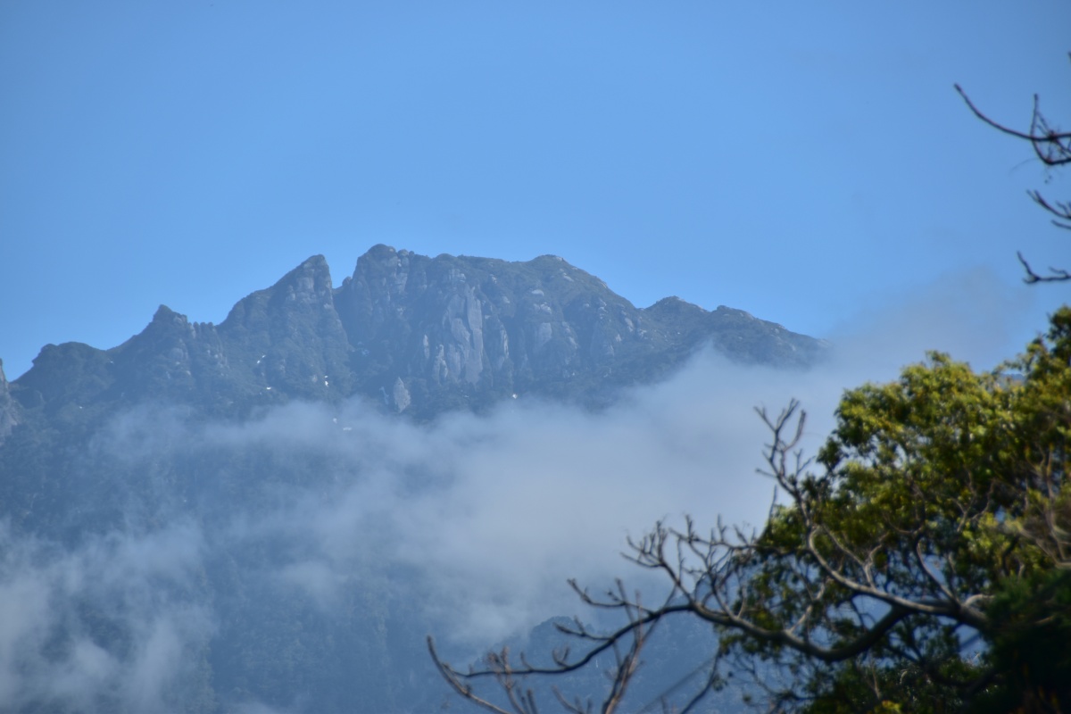
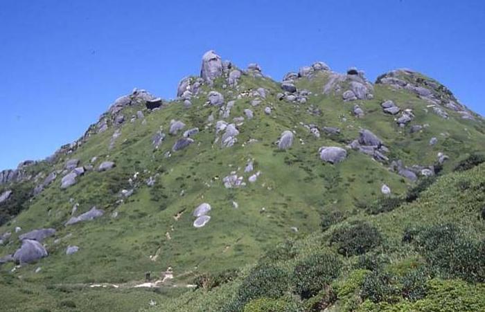
Mt. Nagata at a height of 1,886 meters is the second highest mountain in Kyushu after Mt. Miyanoura. A spectacular view of Mt. Nagata can be seen from the village of Nagata. Mt. Nagata is the only mountain of the Okudake Mountains (the inner mountains of Yakushima Island) that can be seen fully without climbing. From its summit, you can see the Yakusugi cedar forest, the sea turtle nesting beach, and coral reefs. Huge granite outcrops on the summit of Mt. Nagata make for a unique landscape. 
The climbing from Nagata Trail Entrance to the summit of Mt. Nagata is too hard for beginners (only for the advanced level climbers). It is difficult to climb and return in one day taking over 20 hours of round trip and serious climbing.


<Mt. Nagata seen from Nagata village>

→→→ MAP ←←←